Environmental Engineering: Here Comes the Flood
A study predicts a future full of catastrophic flooding in the United States
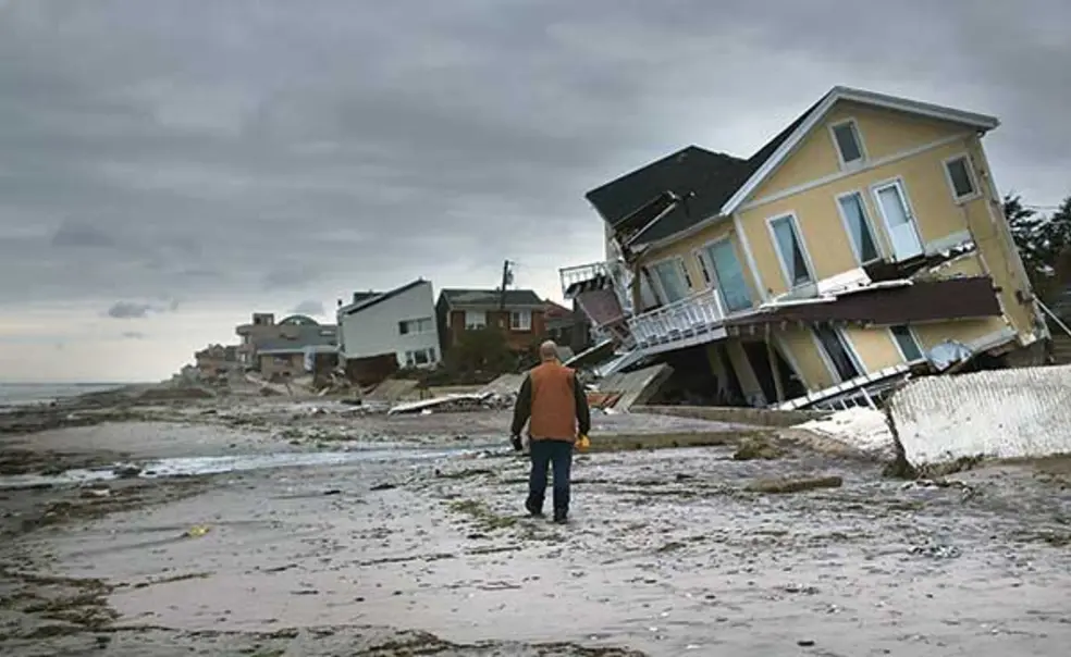
When Hurricane Sandy barreled up the East Coast of the United States in 2012, the storm surge flooded coastal cities from Florida to Maine — especially inundating New York and New Jersey. As it flooded Manhattan subway tunnels and washed away coastal homes, the storm caused damage in excess of $70 billion, making it one of the most destructive weather events in U.S. history.
Such catastrophic storm surges are exceptionally rare, occurring less than once a century. Comparatively less intense storms such as 2011’s Hurricane Irene, which caused an estimated $13.5 billion in damage from Maine to South Carolina, can cause 100-year floods, so called to denote their infrequency.
“We generally think about 100-year floods as rare, extreme events,” says Ning Lin, associate professor of civil and environmental engineering. According to a paper published in August in Nature Communications, however, she and her colleagues predict that by the end of the century, a 100-year flood like the one Irene caused could occur on the East Coast yearly. Even the more extreme flooding caused by Sandy, or 2018 Hurricanes Florence and Michael (which caused $17 billion and $25 billion in damage, respectively) could occur every few years. The study was spearheaded by Reza Marsooli, a former Princeton research scholar who is now an assistant professor at Stevens Institute of Technology in Hoboken, N.J., with assistance from Lin; Kairui Feng GS; and MIT professor Kerry Emanuel. While past models on flooding have used projections for climate-induced sea-level rise, this study was the first to factor in the effect of tropical storms for the entire U.S. East and Gulf coasts. In all, the group combined six different climate models, after independently verifying their accuracy.
The group then drilled down on flood risk, county by county, predicting that for the New England and the mid-Atlantic regions, 100-year floods will occur annually for most areas toward the end of the century. That change is almost entirely accounted for by an increase in sea-level rise. “As the storm-surge level is relatively low at high latitudes, sea-level rise, which is relatively high at high latitudes, causes a more dramatic change in flooding,” Lin says.

For the southern Atlantic and Gulf coasts, the study predicts greater variation in the rate of 100-year floods, ranging from every one to 30 years by century’s end. That change, they found, will be due in almost equal measure to sea-level rise and increased storm activity. “The storm-surge level is high to start with, so the lifting of sea level can’t change as dramatically,” Lin says, “but since intense storms will likely happen more often, they can contribute to a bigger part of that change.”
While the study adds urgency to efforts to slow climate change, the geographic specificity can also help areas plan for worst-case scenarios. Lin says there is much they can do to prepare, including building coastal barriers such as seawalls, house-elevation studies, and wetland conservation.
The study could be used on a larger level to influence environmental policy. Current Federal Emergency Management Agency flood maps are drawn with 100-year flood levels in mind. “They haven’t included the effect of climate change, so the maps send people wrong messages about future risk,” Lin says. Changing those maps could help the government better appropriate resources for disasters, influence future coastal construction, and even encourage people to live farther away from the shoreline — so that when these catastrophic storms do occur, they might cause less damage overall.


No responses yet